Parametric Wildfire Intelligence
Deploy continuous satellite monitoring across any environment and visualize real-time fuel moisture and active fire perimeters through a single pane of glass.
Real-Time Telemetry
satellite_altPinpoint thermal anomalies and map live fuel moisture with high-fidelity multispectral satellite passes every 6 hours.
Critical LFMC
Active Triggers
- Bastrop County High
- Fontainebleau Elevated
Multi-Sensor Satellite Feasibility
Observe active fire perimeters, dNBR severity, and fuel dryness across global high-risk zones.
Global Wildfire Anomaly Tracker
High-Resolution Active Fire Observer
Sounny Fire Science Lab
Every algorithm is grounded in peer-reviewed science. Our student research lineage traces back to the 2011 Bastrop Fire.
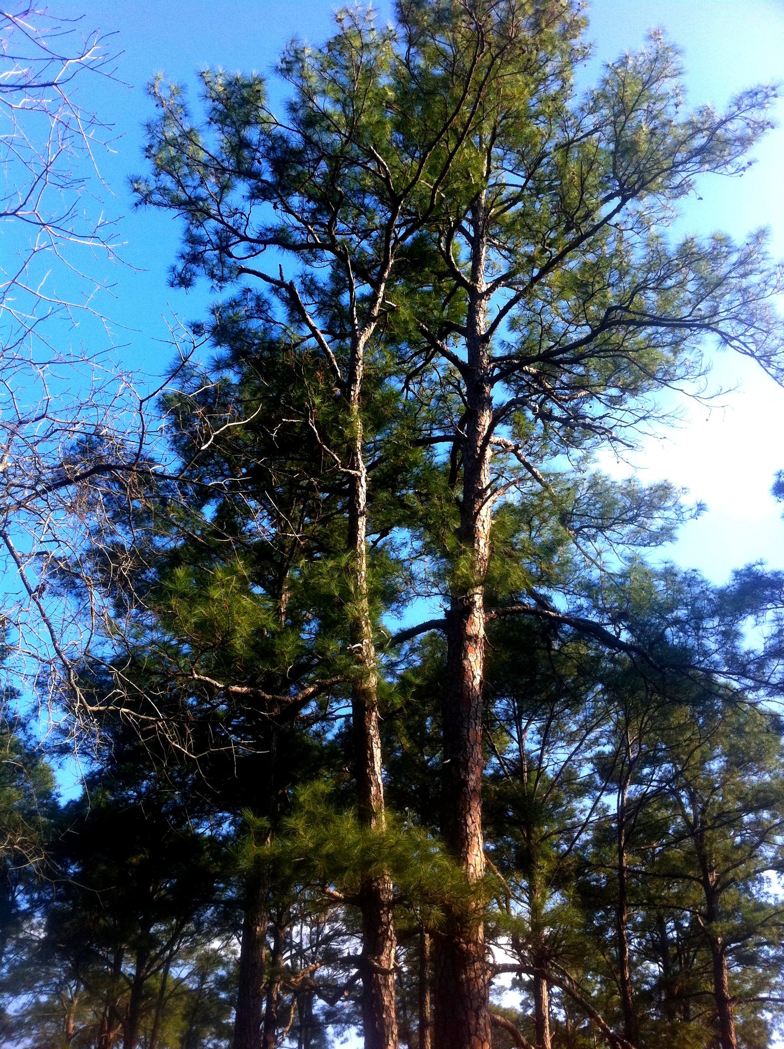 Post-Fire Recovery Field Survey (2013)
Bastrop VMI Case Study (2012)
A Fall 2012 environmental GIS research study applied Vegetation Moisture Index (VMI) to the Bastrop TX fires, demonstrating that spectral fuel moisture indices could identify pre-fire dryness signatures. Direct methodological ancestor of FireIntel's LFMC pipeline.
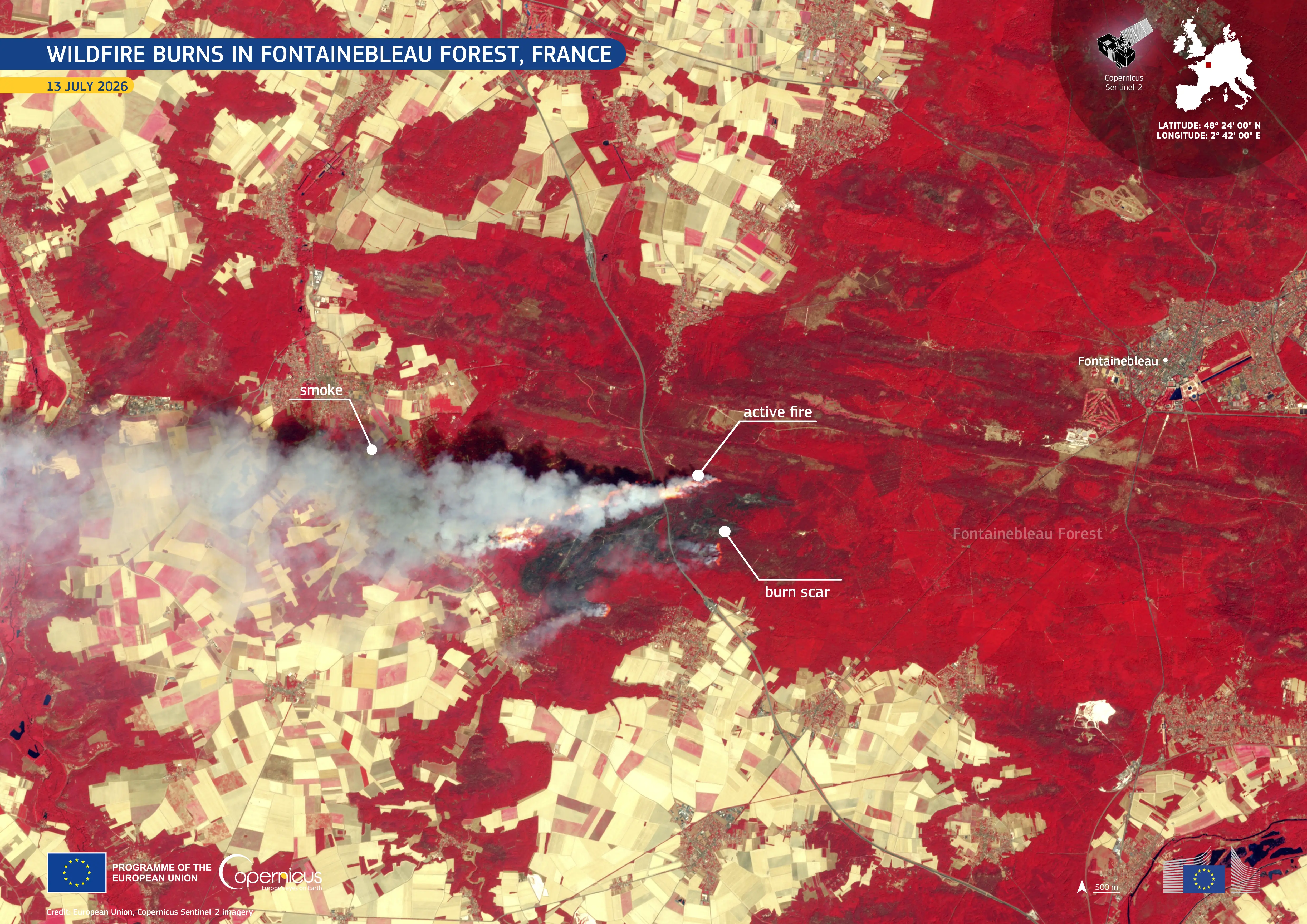 False-Color Infrared (2026)
Fontainebleau Fire Case Study (2026)
Sentinel-2 satellite imagery captures the July 2026 Fontainebleau wildfire. Utilizing false-color infrared, AI isolates active fire fronts (bright orange), distinguishes smoke plumes (gray-white), and maps the extent of healthy vegetation (red) to assess burn scars instantly.
LFMC via PROSAIL Inversion
Live Fuel Moisture Content is retrieved by inverting the PROSAIL radiative transfer model against Sentinel-2 B8A (NIR) and B12 (SWIR) reflectance. Critical threshold: LFMC < 70% → extreme ignition risk.
dNBR Burn Severity Engine
Automated difference Normalized Burn Ratio (dNBR) calculations compute high-resolution post-fire perimeter damage and severity classification within hours of satellite overpass.
Crowd-Sourced Disaster Alerts
Spatial emergency response prototype integrating mobile JSON HTTP servlets with interactive map markers for instant crowd-sourced damage reporting, request tracking, and automated community dispatch.
SAM Zero-Shot Satellite Fire Segmentation
Adapting Meta's Segment Anything Model (SAM) for label-free extraction of active fire fronts and smoke plumes directly from Sentinel-2 and VIIRS satellite imagery, enabling immediate zero-shot perimeter detection.
Interactive PROSAIL Radiative Transfer Sandbox
Adjust Sentinel-2 NIR (B8A) and SWIR-2 (B12) band reflectances to observe live LFMC retrieval and cellular desiccation physics.
NDWI = (B8A - B12) / (B8A + B12) = 0.365PROSAIL Inverted LFMC = 145.2 × NDWI + 32.8% = 85.8%
Cellular water content is declining. Vegetation foliage requires moderate energy for ignition. Prescribed fuelbreaks recommended.
PROSAIL Canopy Spectral Reflectance Signature (400 - 2400 nm)
Observe real-time biophysical optical transitions across Sentinel-2 bands B2, B3, B4, B8A, B11, and B12.
Critical Fire Risk Thresholds (Validated: Bastrop 2012 VMI, Yebra et al. 2013)
Live Fuel Moisture & Burn Analytics
Near real-time Live Fuel Moisture Content (LFMC) nowcasting and automated Sentinel-2 dNBR severity mapping.
Live Fuel Moisture Content (LFMC) Trends
Active Bounding Box dNBR Sweep
Fire Risk Calculator
Enter current weather conditions to estimate fire danger using a Fire Weather Index-inspired model.
Current Conditions
Adjust the weather parameters above and click Calculate to receive tailored fire safety recommendations.
Your personalized fire risk assessment will appear here.
Developer & Enterprise API Plans
Scalable REST API infrastructure for real-time fuel moisture and satellite thermal imagery integration.
Spatial Moisture Feed
- GET /api/v1/fuel-moisture
- MS Planetary Computer STAC
- Live REST Webhooks
- Standard SLA Email Support
dNBR Severity API
- GET /api/v1/fire-detections
- Verified Spatial Perimeter Archive
- Legal SIRET Signature Parity
- Fast 24-hour Report Generation
National Adaptation
- Custom Weather Stations Grid
- Dedicated Spread Simulation GPUs
- Guaranteed 99.9% API Uptime
- Dedicated GIS Solutions Engineer
Fire Adaptation REST API Console
Test endpoints, inspect JSON responses, and integrate satellite fuel moisture into your platform.
Accept: application/json
{
  "status": "success",
  "timestamp": "2026-08-08T10:47:00Z",
  "query": { "lat": 43.24, "lng": 6.32, "region": "Var Region, France" },
  "lfmc_nowcast": {
    "value": 68.2,
    "unit": "percent",
    "threshold_status": "VIGILANCE_ACTIVE",
    "prosail_reflectance": { "b8a_nir": 0.312, "b12_swir": 0.145 }
  },
  "pre_ignition_recommendation": "Deploy prescribed fuelbreak 2km southwest of active zone."
}Nearby Wildfire SMS Emergency Alerts
Get instant automated SMS text alerts on your phone whenever satellite EO detects active thermal anomalies or LFMC dryness drop below 70% within your 50km radius.
Request Platform Access & Pilot Partnership
Fire Intelligence is partnering with pilot insurance underwriters, forestry authorities (ONF), and municipal risk managers across France and the United States to co-deploy automated parametric risk triggers and pre-ignition monitoring.